
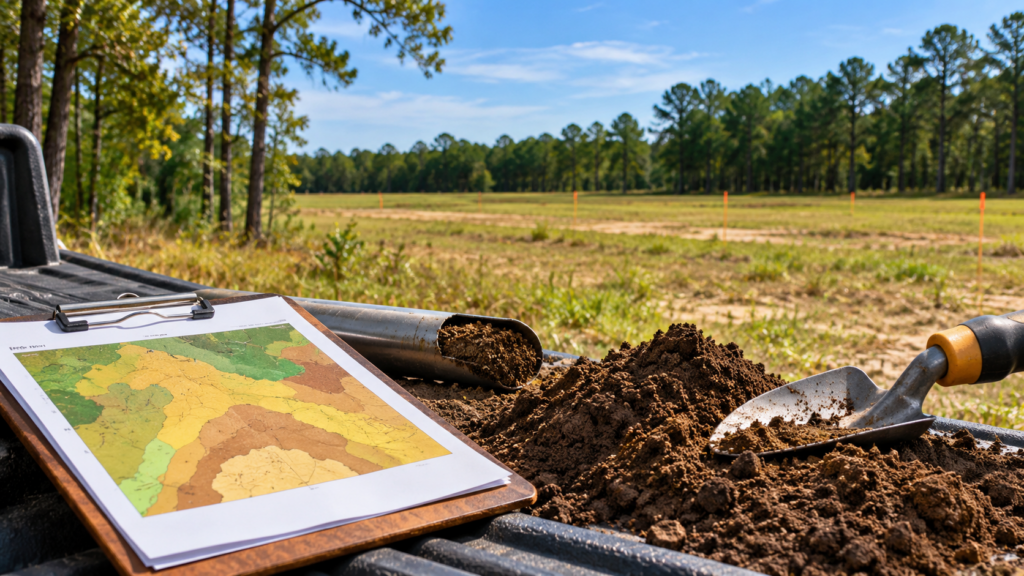
A piece of vacant land may look perfect for development at first glance. It might have good road frontage, a convenient location, and enough acreage for several homes. But what lies beneath the surface can make a significant difference in how that property can be used.
Soil conditions are one of the first things worth understanding when evaluating land for residential development. Two properties of similar size in the same neighborhood can have very different development potential simply because of their soils.
In South Carolina, where coastal plains, wetlands, sandy uplands, and clay-rich soils are common, these differences can affect everything from drainage and septic systems to road construction and building costs.
A soil report can help landowners understand these conditions before making decisions about selling, subdividing, or developing their property.
1. Understanding What a Soil Report Actually Shows
A soil report provides information about the types of soil found on a property and their physical characteristics. One of the most commonly used resources is the USDA Natural Resources Conservation Service (NRCS) Web Soil Survey, which provides soil maps and descriptions for properties across the country.
These reports can identify several important characteristics, including:
- Soil classification: The different soil types mapped across a property.
- Drainage characteristics: How quickly or slowly water moves through the soil.
- Seasonal high water table: How close groundwater may rise to the surface during wetter periods.
- Hydric soil indicators: Soil conditions associated with prolonged saturation and potential wetlands.
- Soil texture and permeability: Whether the soil is predominantly sandy, silty, or clay-rich and how readily water moves through it.
- Shrink-swell potential: Whether certain soils may expand or contract as moisture levels change.
- Development limitations: Potential concerns involving foundations, roads, septic systems, and grading.
For landowners, the value of this information is not necessarily in understanding every technical classification. It is in recognizing whether the property has conditions that could make development relatively straightforward or require additional planning and expense.
It is also important to understand that a USDA soil map is a preliminary planning tool. The mapped boundaries and characteristics are estimates, not a substitute for on-site soil testing, engineering studies, or a formal wetlands determination.
2. Why Drainage and Groundwater Conditions Matter
One of the most important things a soil report can reveal is how water behaves on a property.
Land that appears dry during the summer may experience significant saturation during wetter months. This can be especially relevant in the Lowcountry and other coastal areas of South Carolina, where relatively flat terrain and shallow groundwater can create drainage challenges.
Poorly Drained Soils Can Limit Development
Soils classified as poorly or very poorly drained may hold water near the surface for extended periods.
For residential development, this can create challenges such as:
- Additional stormwater management requirements.
- Higher costs for grading, drainage, or engineered fill.
- Limitations on where roads and building pads can be placed.
- Potential complications with conventional septic systems.
- Reduced flexibility when designing a subdivision.
For example, consider a 20-acre property with approximately 12 acres of well-drained soils and 8 acres of poorly drained soils.
The property may still have development potential, but the most practical building areas could be concentrated within the better-drained portions.
This distinction matters because the total acreage of a property does not always represent the amount of land that can realistically support development.
Seasonal High Water Tables
A seasonal high water table refers to the upper level groundwater may reach during wetter periods of the year.
When groundwater rises close to the surface, it can affect foundation design, underground utilities, road construction, and septic suitability.
A shallow seasonal water table does not automatically prevent development. However, it may require additional engineering or changes to the site layout.
Understanding these conditions early can help landowners avoid assuming that every portion of their property has the same development potential.
3. Soil Conditions Can Affect Septic Systems and Wetlands
For vacant land without access to public sewer, soil conditions can play a major role in determining whether residential development is practical.
Septic Suitability Is Not the Same Across Every Property
A conventional septic system depends on suitable soil conditions to treat and disperse wastewater.
Factors such as soil permeability, depth to groundwater, restrictive soil layers, and available space can affect whether a system is feasible.
Sandy soils may offer favorable drainage characteristics, but excessive permeability or shallow groundwater can still create limitations. Clay-rich soils, meanwhile, may drain too slowly for certain conventional systems.
A soil report can highlight these potential concerns, but it cannot confirm septic approval.
In South Carolina, property owners generally need an appropriate site evaluation and approval through the applicable state permitting process before installing an onsite wastewater system.
For landowners considering subdivision, this becomes particularly important. A property that can accommodate one residence may not necessarily support multiple septic systems without additional testing or alternative designs.
Hydric Soils and Potential Wetlands
Another important part of soil analysis involves identifying hydric soils.
Hydric soils develop under conditions where the ground remains saturated or flooded long enough to create specific soil characteristics.
These soils are commonly associated with wetlands, but the presence of hydric soils alone does not establish a legally regulated wetland boundary.
A formal wetland delineation considers soils, vegetation, and hydrology, and jurisdictional determinations may require review by the appropriate regulatory agencies.
For landowners, a soil report can help identify areas where additional wetland investigation may be worthwhile.
This is particularly relevant in areas such as Charleston, Berkeley, Dorchester, and Horry counties, where wetlands and low-lying land can influence subdivision design.
A property containing wetland-related soils may still offer valuable development opportunities. The key is understanding where potential constraints exist and how they affect the usable portions of the land.
4. How Soil Types Influence Construction Costs and Lot Yield
Soil conditions do more than determine whether land can be developed. They can also influence how much development may cost.
When developers evaluate vacant land, they consider the amount of work required to prepare the property for roads, utilities, drainage systems, and building pads.
Grading, Fill, and Earthwork
Some properties have relatively favorable soil conditions and natural elevations that require limited site preparation.
Others may need substantial grading, soil stabilization, drainage improvements, or imported fill material.
For example, a property with low-lying, poorly drained soils may require raised building pads or additional drainage infrastructure, subject to engineering and permitting requirements.
These improvements can increase development costs.
On the other hand, a property with stable, well-drained soils and favorable topography may offer more flexibility during site design.
Soil reports can also identify clay-rich soils with shrink-swell potential. These soils may expand when wet and contract as they dry, potentially affecting pavement and foundation performance if not properly addressed.
However, actual construction suitability must be confirmed through site-specific geotechnical testing.
Soil Conditions and Subdivision Lot Yield
Lot yield refers to the number of lots that can reasonably be created from a property while meeting applicable zoning, access, infrastructure, and environmental requirements.
Soil conditions can influence this number.
Consider two hypothetical 15-acre properties in the same zoning district.
Property A consists primarily of well-drained soils with limited mapped constraints. Its soil conditions may allow greater flexibility in locating roads, stormwater facilities, and residential lots.
Property B contains substantial areas of poorly drained soils, shallow groundwater, and potential wetlands. Its subdivision layout may need to avoid or accommodate those areas, potentially reducing the number of practical lots.
Even if both properties have the same zoning designation and total acreage, their development costs and achievable lot counts may differ.
This is one reason land buyers and developers look beyond acreage when evaluating vacant property.
Landowners interested in understanding other factors that affect subdivision potential can also explore our resources on South Carolina land development requirements and local zoning considerations.
5. What Landowners Should Do After Reviewing a Soil Report
A soil report is most useful when it becomes part of a broader property evaluation.
Rather than viewing a soil classification as a simple pass-or-fail result, landowners should consider how the findings relate to their goals.
Compare Soil Conditions With Other Property Features
Soils should be evaluated alongside several other factors, including:
- Existing zoning and minimum lot size requirements.
- Public water and sewer availability.
- Road frontage and legal access.
- Wetlands, floodplains, and drainage features.
- Topography and natural elevations.
- Local subdivision and stormwater regulations.
For instance, a property with less favorable soils may still be attractive if public sewer is available and the development layout can accommodate drainage limitations.
Conversely, land with excellent soils may face development restrictions because of zoning, limited access, or unavailable utilities.
No single factor determines a property’s development potential.
Know When Additional Testing Is Necessary
If a preliminary soil report identifies potential constraints, additional professional evaluations may be appropriate.
Depending on the property and intended use, these may include a geotechnical investigation, septic soil evaluation, wetland delineation, topographic survey, or preliminary engineering review.
These studies provide more detailed information than generalized soil mapping.
Landowners do not necessarily need to complete every study before selling. In many cases, understanding the likely concerns and gathering existing property records can be a useful starting point.
Understand How Soil Conditions May Affect Land Value
Soil limitations do not automatically make a property undesirable.
What matters is how those conditions influence the cost, timing, and feasibility of a potential project.
A developer may still be interested in land with drainage challenges if the location, zoning, and expected lot values support the additional improvements.
Likewise, a property with favorable soils may attract interest because it offers fewer apparent construction challenges.
For landowners, having a basic understanding of soil conditions can make conversations with prospective buyers more productive and help establish realistic expectations about development potential.
If you’re considering selling, our Sell Your Land page provides more information about how Southern Acres Land Co. evaluates vacant properties and works with landowners.
The Bottom Line: What Lies Beneath the Land Matters
Vacant land is often evaluated by what can be seen from the road: acreage, location, access, and surrounding development.
But the soil beneath the property can be just as important.
Drainage characteristics, seasonal groundwater, septic suitability, and potential wetland conditions all influence how land may be developed. These factors can affect construction costs, subdivision layouts, and ultimately the property’s appeal to prospective buyers.
A soil report will not answer every development question, but it can reveal important considerations that might otherwise be overlooked.
For landowners, that information provides a clearer starting point for understanding what their property may realistically support.
If you own land in South Carolina and are exploring your options, the team at Southern Acres Land Co. is always happy to share insights and answer questions. Feel free to reach out through our Contact Us page to start a conversation.