
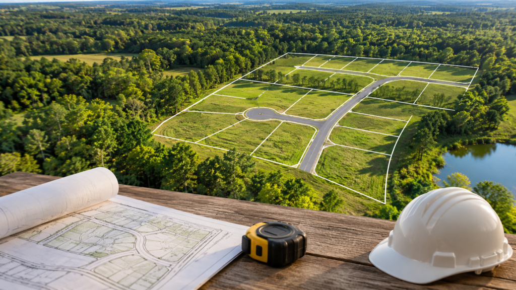
If you own several acres of vacant land in South Carolina, you may have wondered how many homes could eventually be built on your property. Maybe a developer has approached you about buying your land, or perhaps you’ve noticed new subdivisions appearing nearby and started wondering what your own property might be worth.
At first glance, figuring out how many lots can fit on a piece of land seems like a simple math problem. Divide the total acreage by the minimum lot size, and you have your answer, right?
Not quite.
Residential development involves much more than dividing land into smaller pieces. Zoning regulations, road access, utilities, drainage, wetlands, and even the shape of a property can influence how many homes can realistically be built.
Understanding density and how it affects development potential can help landowners make more informed decisions about their property, especially when considering a future sale.
1. What Does Density Mean in Land Development?
In residential development, density generally refers to the number of dwelling units that can be built within a given area of land. It is commonly expressed as dwelling units per acre.
For example, a zoning district that allows four dwelling units per acre may theoretically permit 40 homes on a 10-acre property.
However, that number represents a starting point, not necessarily the number of homes that will ultimately be approved or constructed.
There are two important ways to look at density:
- Gross density: The number of dwelling units calculated using the property’s total acreage.
- Net density: The number of dwelling units calculated using the land area remaining after certain exclusions, such as roads, protected areas, or other land that cannot be used for residential lots, depending on the local ordinance.
This distinction matters because not every acre of a property can necessarily be used for housing.
A 20-acre tract may contain wetlands, steep slopes, drainage areas, or utility easements. Even though the deed identifies the property as 20 acres, the actual area available for residential lots could be considerably smaller.
For landowners, understanding this difference helps explain why two properties with the same acreage and zoning can have very different development potential.
2. How Zoning Determines the Starting Lot Count
One of the first things a developer looks at when evaluating vacant land is its zoning classification.
Zoning establishes what types of development are permitted on a property and often determines how densely the land can be developed.
Depending on the county or municipality in South Carolina, residential zoning regulations may include requirements for:
- Minimum lot size
- Maximum residential density
- Minimum lot width and road frontage
- Building setbacks
- Open space and buffer areas
- Permitted housing types, such as single-family homes or townhomes
- Subdivision design and road standards
For example, suppose you own 10 acres in a residential zoning district that requires a minimum lot size of 10,000 square feet.
Since one acre contains 43,560 square feet, your property contains approximately 435,600 square feet.
Dividing that area by the minimum lot size gives you a theoretical maximum of 43 whole lots.
But that calculation assumes every square foot of the property can be divided into residential lots. It also assumes there are no additional density restrictions or development requirements that would reduce the count.
In reality, a portion of the land will likely be needed for roads, stormwater management, utility infrastructure, and other improvements.
Local regulations can also vary significantly. A property in Charleston County may be subject to different subdivision requirements than a similar property in Berkeley County or Dorchester County.
Landowners interested in the Charleston area may find it helpful to learn more about Charleston County real estate and local land development trends, particularly how growth and development regulations influence the potential uses of vacant land.
It is also important to remember that the zoning shown on a property record does not always tell the entire story. Overlay districts, future land use plans, and additional local ordinances may affect what can ultimately be approved.
3. Why the Actual Number of Lots Is Often Lower Than Expected
A common surprise for landowners is discovering that the number of lots a developer can realistically create is lower than the number suggested by zoning alone.
This is because residential subdivisions require more than individual home sites. They also need the infrastructure and supporting land necessary to function as a community.
Several factors can reduce the usable acreage of a property.
Roads and access
New subdivisions typically require internal roads, intersections, and connections to existing public roads.
Depending on the size and layout of the development, roads can occupy a meaningful portion of the property. Requirements for road widths, emergency access, sidewalks, and rights-of-way may further affect the available space.
A property with limited road frontage may also face challenges accommodating an appropriate subdivision entrance.
Wetlands and flood-prone areas
Many properties in South Carolina, particularly in coastal and low-lying areas, contain wetlands or land that is susceptible to flooding.
These areas may require environmental permits, buffers, or design adjustments. Some portions of the property may need to remain undisturbed.
A 15-acre tract with five acres of wetlands, for example, may have significantly less flexibility than a similarly sized tract consisting primarily of uplands.
Wetlands do not automatically make a property undevelopable, but their location and extent can influence the layout, cost, and number of residential lots.
Stormwater management
When vacant land is developed, rooftops, roads, and driveways change how rainwater moves across the property.
Developers must account for this by providing appropriate stormwater management facilities, which may include detention ponds, retention ponds, drainage systems, or other approved measures.
These facilities can require substantial space, particularly on properties with poor drainage or shallow groundwater.
The land used for stormwater infrastructure generally cannot also be counted as ordinary residential lot area.
Utilities and soil conditions
Access to public water and sewer can make a significant difference in how densely a property can be developed.
When public sewer is unavailable, individual septic systems may be necessary. Septic requirements can increase the amount of land needed for each home, especially where soils have limited drainage or wastewater absorption capacity.
Even when public utilities are nearby, their available capacity and the cost of extending service can affect the feasibility of a development.
Soil conditions also influence construction. Properties with unstable soils, shallow groundwater, or extensive grading needs may require additional engineering and site preparation.
These considerations can reduce the practical lot count or make certain portions of the property less economical to develop.
Property shape and topography
A property’s acreage does not necessarily reflect how efficiently it can be divided.
A relatively square, flat 10-acre tract may accommodate a more efficient subdivision layout than a long, narrow 10-acre tract with irregular boundaries.
Steep slopes, drainage channels, easements, and unusual property configurations can create areas that are difficult to incorporate into residential lots.
Sometimes, a smaller property with favorable dimensions and access can accommodate nearly as many homes as a larger but more constrained tract.
4. A Practical Example: How Many Lots Could Fit on 20 Acres?
Consider a hypothetical 20-acre property in South Carolina that is zoned for residential development with a minimum lot size of 10,000 square feet.
At first glance, the calculation looks straightforward.
Twenty acres equals 871,200 square feet. Dividing that by 10,000 square feet suggests that approximately 87 whole lots could fit on the property.
Now consider what happens when other development requirements are taken into account.
| Land Use | Estimated Acreage |
|---|---|
| Total property acreage | 20 acres |
| Wetlands and protected areas | 3 acres |
| Roads and rights-of-way | 3 acres |
| Stormwater management | 2 acres |
| Buffers and common areas | 1 acre |
| Remaining area for residential lots | 11 acres |
After accounting for these hypothetical requirements, approximately 11 acres remain available for residential lots.
Eleven acres equals 479,160 square feet. At a minimum lot size of 10,000 square feet, that would provide enough area for approximately 47 whole lots on paper.
The final number could be lower once engineers account for lot widths, setbacks, road geometry, utility easements, and the actual configuration of the property.
The difference between the original estimate of 87 lots and the adjusted estimate of 47 lots is substantial.
This is why developers often distinguish between theoretical density and realistic lot yield.
Lot yield refers to the number of lots that can reasonably be created based on the property’s physical characteristics, applicable regulations, and proposed development layout.
A developer may prepare a preliminary concept plan to determine how those lots could fit together while meeting local requirements.
Of course, every property is different. The acreage allocations in this example are illustrative, not standard requirements. Some properties may require considerably less land for infrastructure, while others may face greater constraints.
The purpose of a preliminary layout is to move beyond simple acreage calculations and develop a more realistic understanding of what the land can support.
5. What Density and Lot Yield Mean for Your Land’s Value
For landowners considering selling their property, understanding potential lot yield can provide useful insight into how developers evaluate land.
Developers often work backward from the number of homes or finished lots a property could support.
They consider the potential value of those lots and subtract the estimated costs of developing the property, including infrastructure, engineering, permitting, financing, and other expenses.
The remaining amount helps determine what they may be able to pay for the land while maintaining a financially feasible project.
This means that a property with a higher realistic lot yield may support a higher purchase price, assuming the development costs and market conditions are comparable.
However, higher density does not automatically mean higher land value.
For example, a property that could support 60 residential lots but requires expensive sewer extensions, extensive grading, and complicated environmental approvals may be less attractive than a property that can accommodate 40 lots with readily available utilities and relatively straightforward site conditions.
The overall feasibility of the development matters just as much as the number of lots.
What can landowners do to better understand their property’s potential?
You do not necessarily need to hire an engineer or prepare a complete subdivision plan before exploring your options.
A few basic steps can help you gain a clearer understanding of your land:
- Confirm your property’s current zoning with the local planning department.
- Review minimum lot sizes and applicable residential density limits.
- Check whether public water and sewer are available nearby.
- Identify potential wetlands, flood zones, and drainage concerns.
- Review property surveys, easements, and road frontage.
- Learn about nearby residential developments and local subdivision requirements.
These steps can provide a useful starting point for discussions with developers or land professionals.
If you are considering selling, understanding these factors can also help you evaluate offers more confidently and recognize why different buyers may arrive at different valuations for the same property.
Understanding Your Land’s True Development Potential
The number of residential lots that can fit on a property is rarely determined by acreage alone.
Zoning provides the initial framework, but infrastructure, environmental conditions, utility availability, and subdivision design all influence the final outcome.
For landowners in South Carolina, understanding these factors can make it easier to see their property from a developer’s perspective and make informed decisions about its future.
Whether your land could support a small residential subdivision or a larger community, the most useful starting point is understanding what is realistically possible rather than relying solely on theoretical density calculations.
At Southern Acres Land Co., we evaluate vacant land with these considerations in mind, looking beyond acreage to understand each property’s individual development potential.
If you own land in South Carolina and are exploring your options, our team is always happy to share insights and answer questions. You can learn more about our approach on our Sell Your Land page or reach out whenever you are ready to discuss your property.